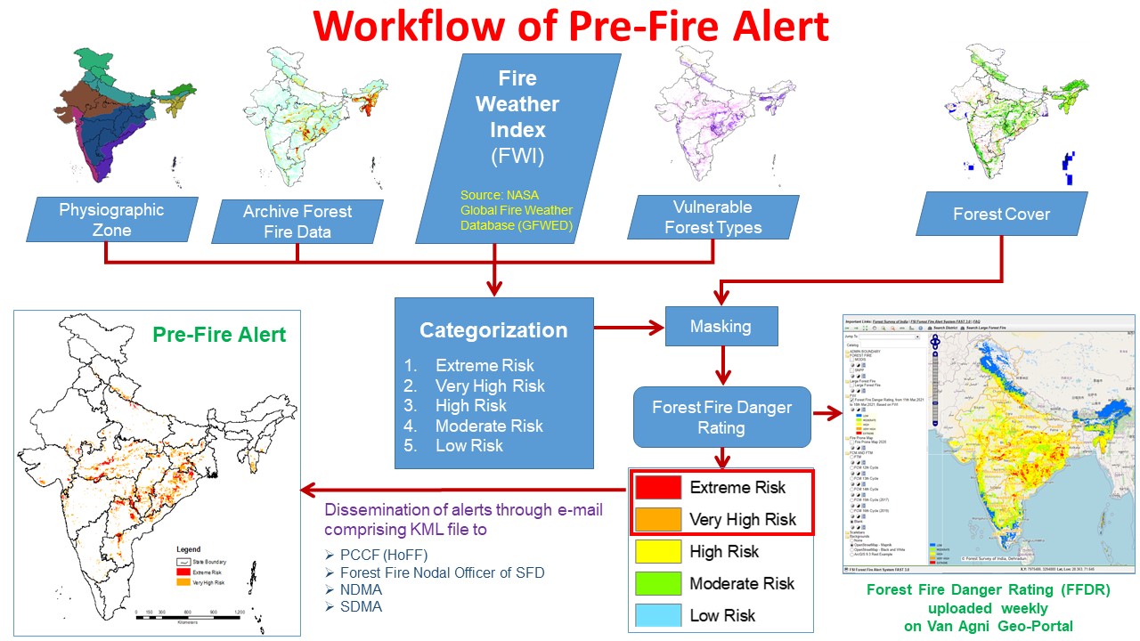
Early warnings about susceptible forest fire regions are useful in taking timely preventive measures to avoid their occurrence and related losses. Since 2016, FSI is working on developing danger rating system based on daily weather data, forest fuel load, and terrain conditions.
FSI is currently working on a system similar to Canadian Forest Fire Danger Rating System (CFFDRS), based on Fire Weather Index (FWI) for forest fire danger rating in India. Additionally, Forest Type Layer information, Forest Fire Archival information, and other data are also being used to generate Forest Fire Danger Rating. The parameters are quantified and overlaid on grids of 5 km X 5 km.
The FWI values from GEOS-5 daily database from NASA’s GFWED database are downloaded and thresholds are customized for different physiographic zones of the country. On the basis of various sets of decisions, the FWI classes are again reclassified based on the vulnerability (based on Forest Types Maps), archival forest fire data, active large forest fire event, and forecast rainfall data. The Fire Danger Rating is categorized into five classes- Extreme Risk, Very High Risk, High Risk, Moderate Risk, and Low Risk; and uploaded as Web Map Service (WMS) in the Van Agni Geo-portal of FSI.
The National Disaster Management Authority (NDMA), has conceptualized a Common Alerting Protocol (CAP) based Integrated Alert System for disasters at pan-India level. This project entails timely dissemination of early warnings through various technological means, utilizing geo-information. FSI established as one of the Alert Generating Agency (AGA) since March 2023, is responsible for uploading Pre-Fire Alert data onto the SACHET Portal. This data is subsequently broadcast to public as Pre-Fire Alerts by the respective State Disaster Management Authorities (SDMA) after assessing the local environment, climatic and other related factors.