Forest fires, if undetected and not extinguished on time, may turn into large forest fires that cause wide spread destruction. Such fires require extensive resources in terms of firefighting force, materials, equipment, and other logistical support for containment. Timely information and tracking of such large fire events helps in devising strategies for planning and resource mobilization for their effective containment, thereby minimizing losses to forests.
To assist the SFDs in effective management of large forest fire (LFF) events, a satellite based automated system of monitoring was developed and launched in 2019. The objectives of this programme are given below:
- Continuous monitoring and tracking of large forest fires in near real-time.
- Timely containment of such fires by SFDs.
- Escalation of alerts to higher level for timely additional support from agencies such as District Administration, SDMA, NDMA, Armed forces, etc.
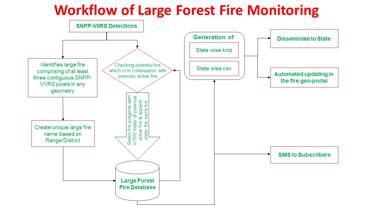
- Development of a National Large Forest Fire Database for future planning; especially in development of State Crisis Management Plans and Working Plans.
- For planning of burnt area restoration programmes.
The LFF programme uses the SNPP-VIIRS sensor (375 m X 375 m resolution) fire hotspot data. The application identifies a candidate large fire through an automated algorithm, which identifies large fire comprising of at least three contiguous SNPP-VIIRS pixels in any geometry having area more than ~40 ha. Once the candidate large fire is detected, it is continuously monitored using data from subsequent satellite passes as long as the fire is active. The continuous tracking of the identified event is achieved by monitoring the estimated fire boundary, which is also continuously updated as per the changes in direction of the fire event. The program scans the area for additional three days after its inactivity to detect dormant fires, if any, restarting in the same area again.
Information on the number of fire affected active pixels, total number of fire affected pixels, administrative and management boundaries, KMZ file, and web-linked *.png map of the fire location, etc., are provided as e-mail to the Principal Chief Conservator of Forests (Head of Forest Force), and Nodal Officers of SFDs; and as SMS to all the registered subscribers.