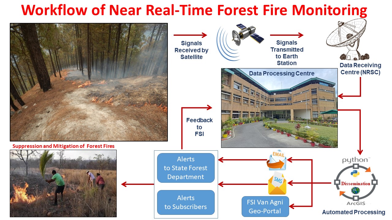
Forest Survey of India (FSI) has been alerting State Forest Departments about forest fire incidences detected by MODIS (Moderate Resolution Imaging Spectro-radiometer) sensor on-board Aqua and Terra Satellite of NASA and based on SNPP- VIIRS sensor.
The fire hotspots detected by MODIS (1 km X 1 km resolution) and SNPP-VIIRS (375 m X 375 m resolution) sensors are received at Shadnagar Earth station (National Remote Sensing Centre) and processed using standard algorithm. The fire hotspots are electronically shared with FSI, which are further processed automatically at FSI headquarters in Dehradun and alerts are generated and disseminated to the registered end users as SMS. The same is also disseminated in the form of KML and CSV through e-mail. Automation of the entire process has reduced the processing time to a great extent, which has resulted in information being disseminated to SFDs in the shortest possible time for facilitating quick responses by the field teams in fire containment activities.
The forest fire detections generated by FSI are primarily thermal anomalies captured by the satellites and as such, the number of fire incidences on ground may vary from the detections sent as alerts, owing to various reasons. This may be due to fire detections being reported on successive days for the same fire incident owing to satellite’s repeativity.
Based on the analysis of the near real-time forest fire data and feedback from the SFDs, FSI has developed a filter to mask out fires from mining areas, industrial areas, etc., which may otherwise add false alarms to the forest fire alert system. After filtering, all the subscribers are notified through SMS about the forest fires that have been detected within their area of interest. This information is also shared with State Nodal Officers through e-mail. The information is also uploaded online on the FSI website and Van Agni Geo-portal.